
主办单位:煤炭科学研究总院有限公司、中国煤炭学会学术期刊工作委员会
Water inrush mechanism and water-conducting fractured zone’ developmental patterns of a typical ultra-thick coal seam in the Huanglong coalfield during fully mechanized mining
YAN Heping;LI Wenping;DUAN Zhonghui;YANG Yugui
中国矿业大学 资源与地球科学学院陕西省一九四煤田地质有限公司自然资源部煤炭资源勘查与综合利用重点实验室中国矿业大学 深地工程智能建造与健康运维全国重点实验室
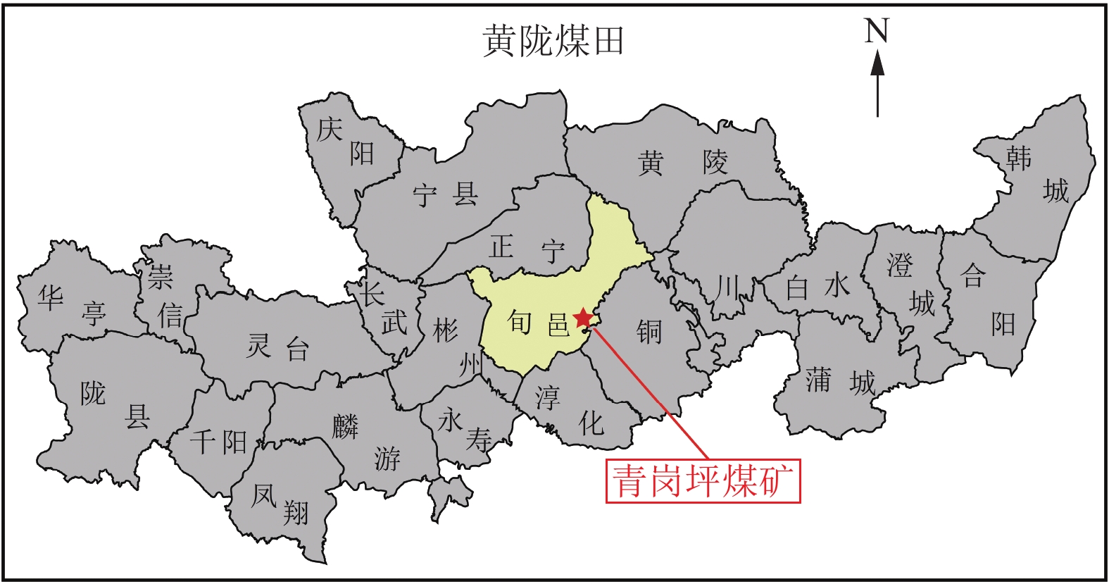
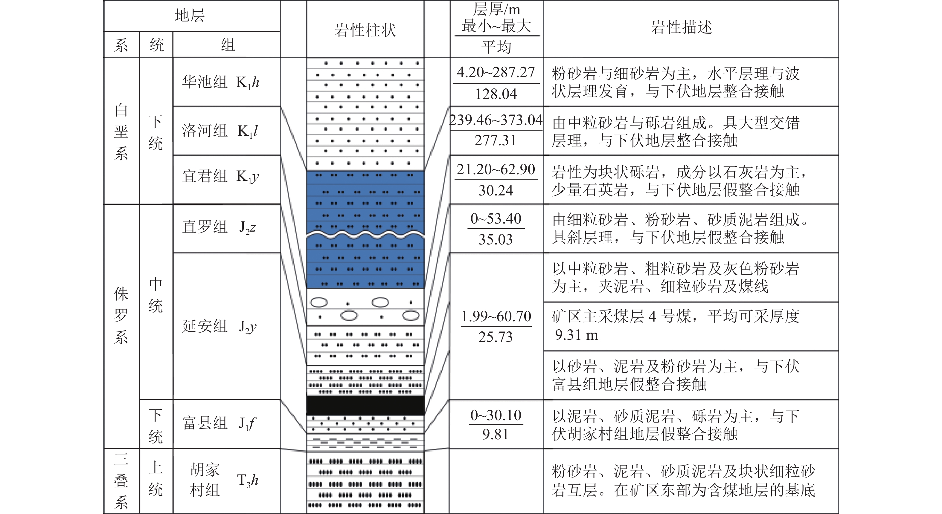
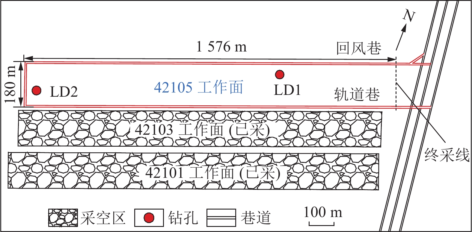
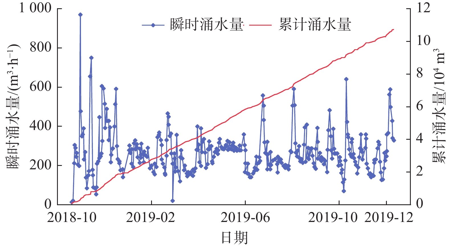
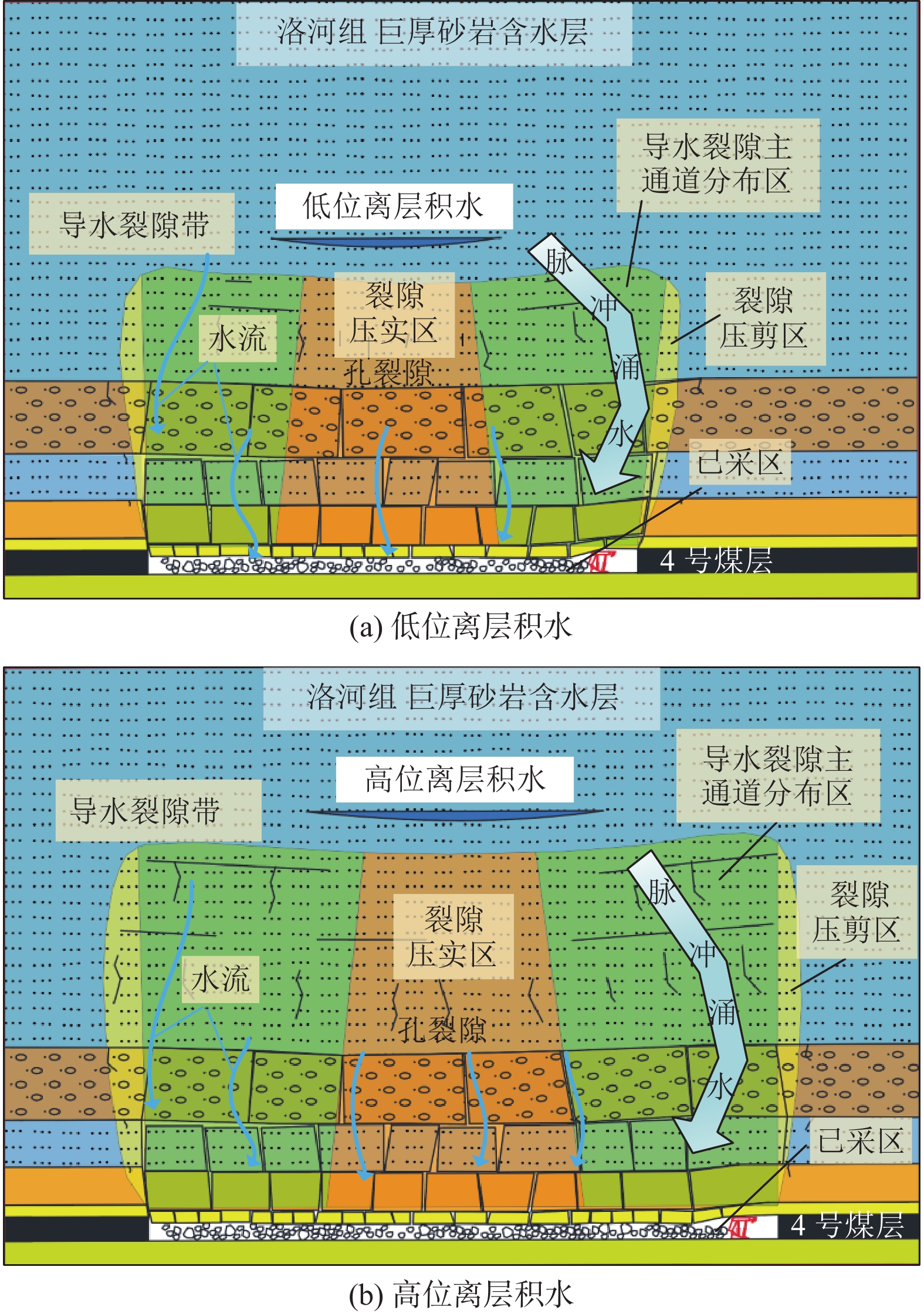
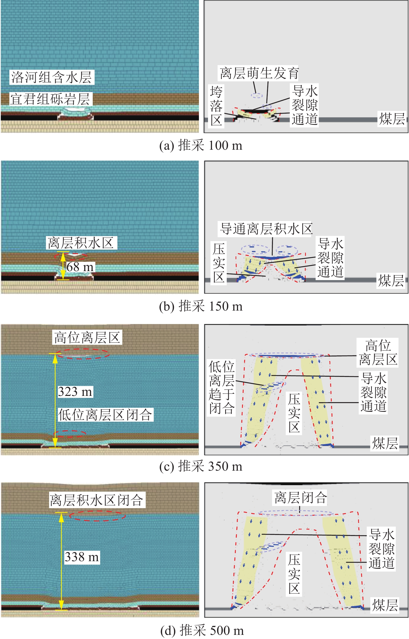
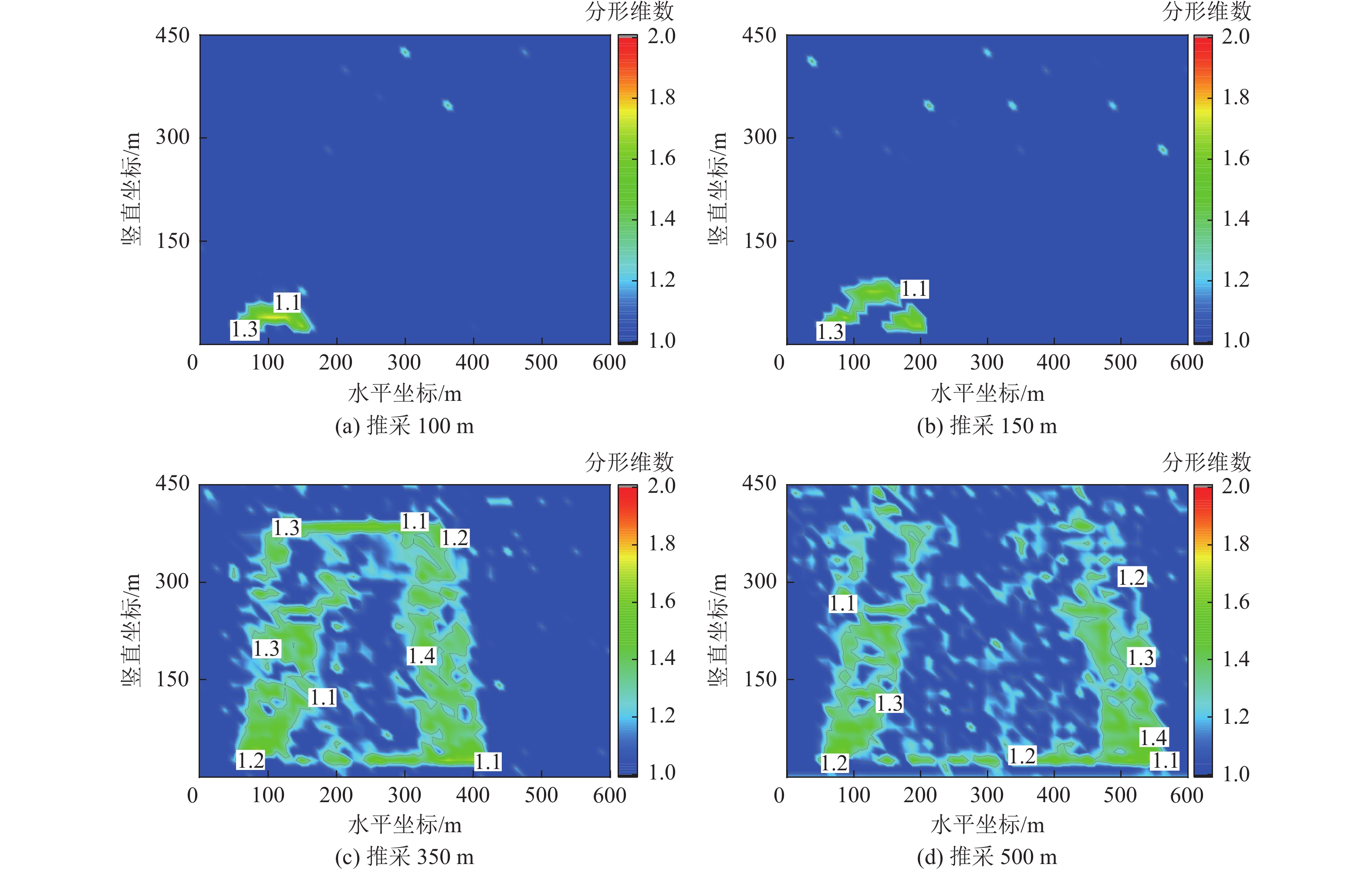
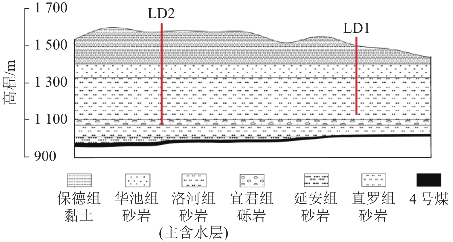
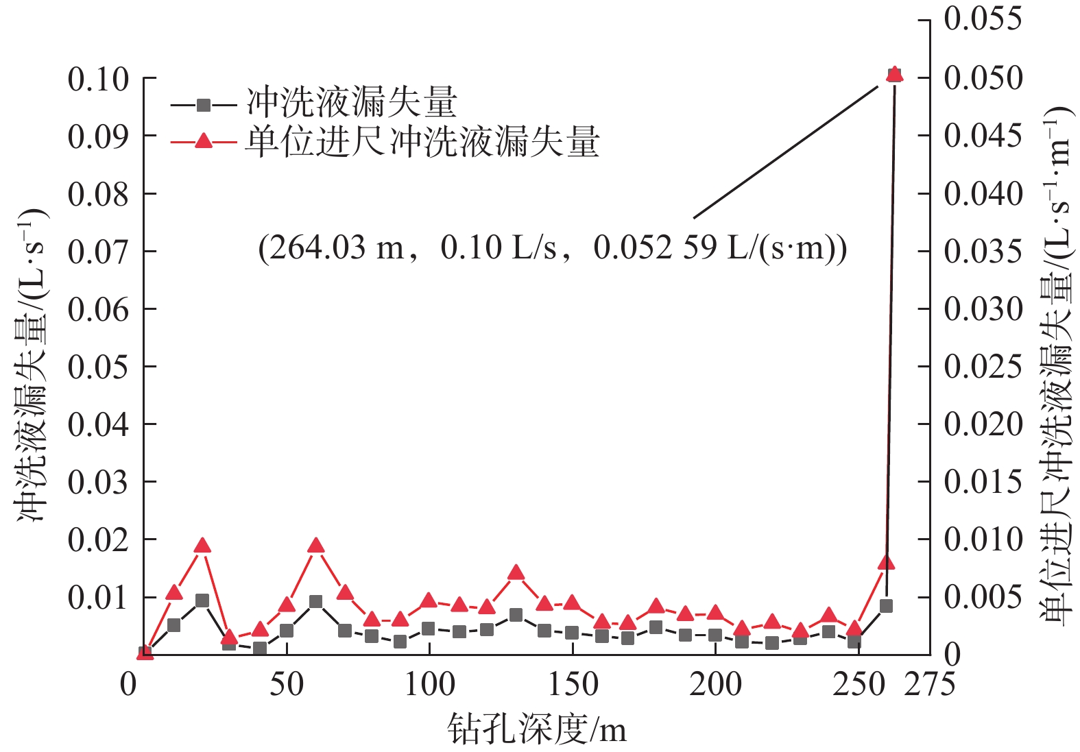
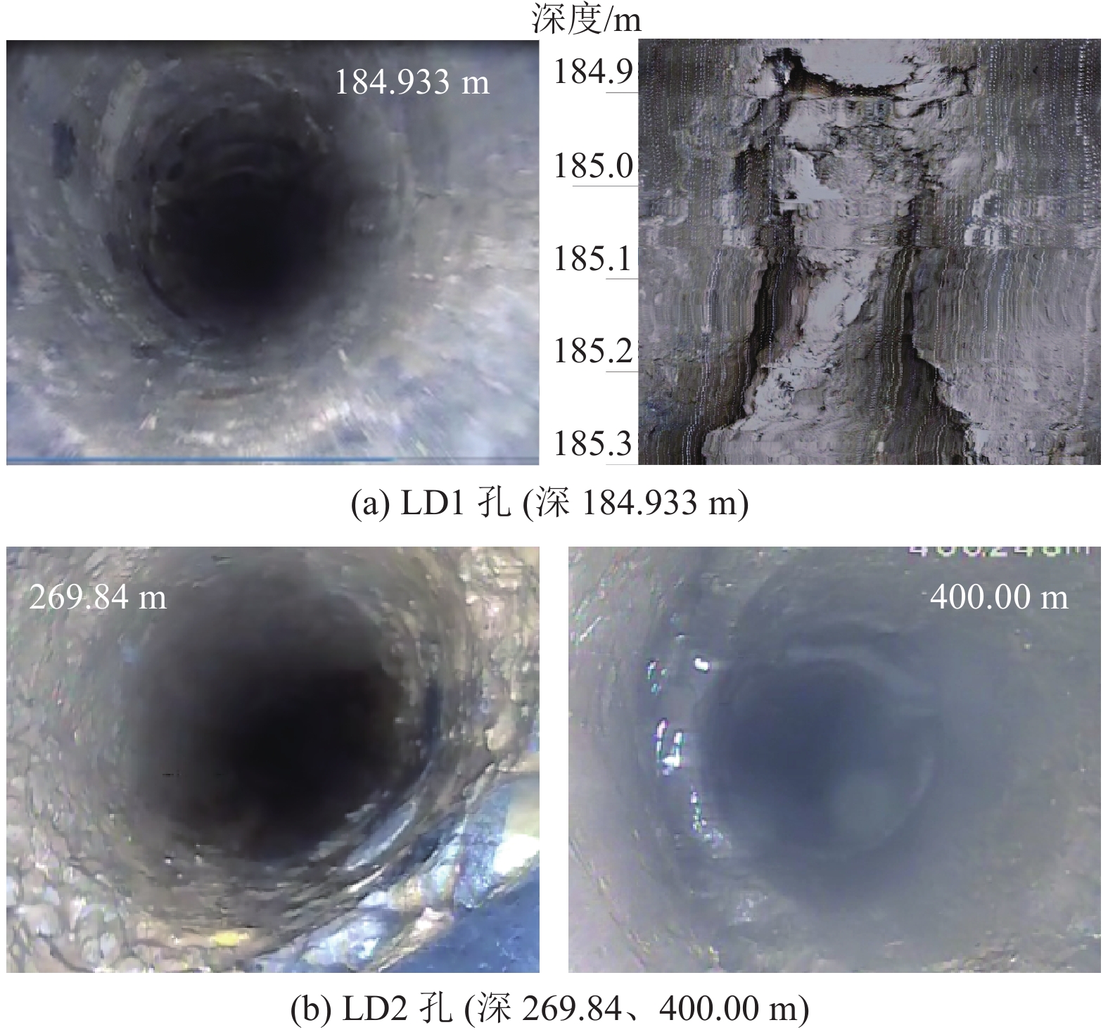
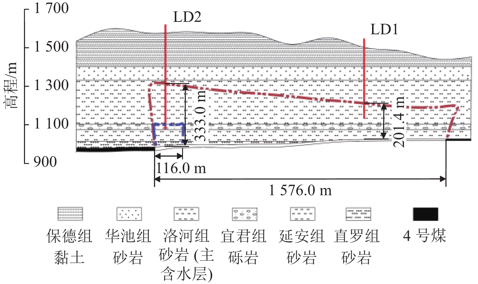
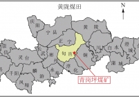
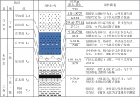
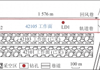
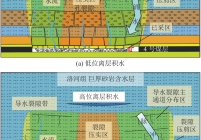
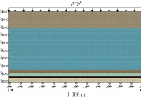
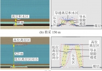
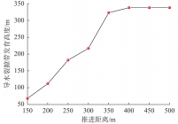
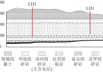
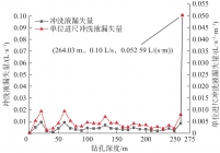
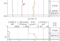
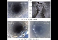
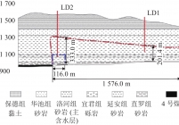
黄陇侏罗纪煤田厚煤层开采导水裂隙带发育高度大,易导通上覆白垩系洛河组巨厚砂岩含水层,区内青岗坪煤矿回采期间出现典型的“脉冲式”涌水特征,给矿井的安全回采造成严重影响。以青岗坪煤矿42105综放工作面为研究对象,采用3DEC离散元模拟、钻孔冲洗液漏失量、综合物探以及钻孔电视相结合的实测方法,对工作面回采过程中覆岩导水裂隙带和离层发育规律进行研究,探究该典型地质条件下矿井的涌水机制与导水裂隙带发育特征。结果表明:42105工作面导水裂隙带受覆岩周期性垮落影响不断向上发育,洛河组孔裂隙砂岩静储水不断释放,间歇性涌入工作面,形成幅值稍低的“脉冲式”涌水;在采动影响下巨厚砂岩含水层内不断出现离层,导水裂隙带导通砂岩含水层离层积水区,致使涌入工作面的瞬时涌水量突增,形成幅值较高的“脉冲式”涌水。结合现场钻孔冲洗液漏失量实测、综合物探以及钻孔电视结果,揭示了青岗坪煤矿洛河组孔裂隙砂岩静储水与离层水叠加影响的“脉冲式”涌水机理,确定导水裂隙带的最大发育高度为316.83~333.00 m,裂采比为30.17~31.71。研究结果对于类似地层条件下矿井涌水的防治和安全高效回采具有指导意义。
The mining of thick coal seams in the Huanglong Jurassic coalfield has led to the formation of high water-conducting fractured zones, which are prone to connect the extremely thick sandstone aquifers of the overlying Cretaceous Luohe Formation. Qinggangping Coal Mine in the coalfield exhibits the typical characteristics of pulsed water inrushes during coal mining, posing a severe threat to safe mining. This study investigated the fully mechanized mining face 42105 in Qinggangping Coal Mine. Using 3DEC discrete element simulation, flushing fluid leakage in boreholes, integrated geophysical exploration, and borehole TV, this study examined the developmental patterns of the water-conducting fractured zone and detachment layers in the overburden during coal mining. Furthermore, it explored the water inrush mechanism and the developmental characteristics of the water-conducting fractured zone in a mine under the typical geological conditions. Key findings are as follows: (1) The water-conducting fractured zone along mining face 42105 continuously has extended upward under the periodic collapse of the overburden. Consequently, the static water in porous-fractured sandstones in the Luohe Formation is constantly released and intermittently rushes into the mining face, forming low-amplitude pulsed water inrushes. (2) Detachment layers have been continuously formed in the extremely thick sandstone aquifers, and, accordingly, the water-conducting fractured zone is connected to the water accumulation area of detachment layers in the sandstone aquifers. As a result, instantaneous water inflow into the mining face increases sharply, forming high-amplitude pulsed water inrush. (3) In combination with the measured flushing fluid leakage in boreholes, as well as the results from integrated geophysical exploration and borehole TV, this study revealed the pulsed water inrush mechanism subjected to the superimposed influence of both the static water in porous-fractured sandstones in the Luohe Formation and water in the detachment layers in the Qinggangping Coal Mine. The maximum height of the water-conducting fractured zone was determined at 316.83 m to 333.00 m, with ratios of the height of the water-conducting fractured zone to the mining height ranging from 30.17 to 31.71. The findings of this study can serve as a guide for the prevention and control of water inrushes in mines, as well as safe and efficient coal mining, under similar formation conditions.
Huanglong Coalfield;ultra-thick coal seam;water-conducting fractured zone;pulsed water inrush;integrated detection;discrete element simulation
![青岗坪煤矿42105工作面涌水量历时曲线[9]](/data/tmp/titlepic/377ce6d5ad575d17e771cd0e8923af85.jpg)


主办单位:煤炭科学研究总院有限公司 中国煤炭学会学术期刊工作委员会
 煤田地质与勘探
  2024年第05期